- Sunrise Stat
- Posts
- 🌅 One of the Strongest El Niños Ever
🌅 One of the Strongest El Niños Ever
Sunrise Stat
April 16, 2026
Uncover the power of a single statistic: Sign up for Sunrise Stat to find your intellectual clarity.
SOURCE
WHAT TO KNOW
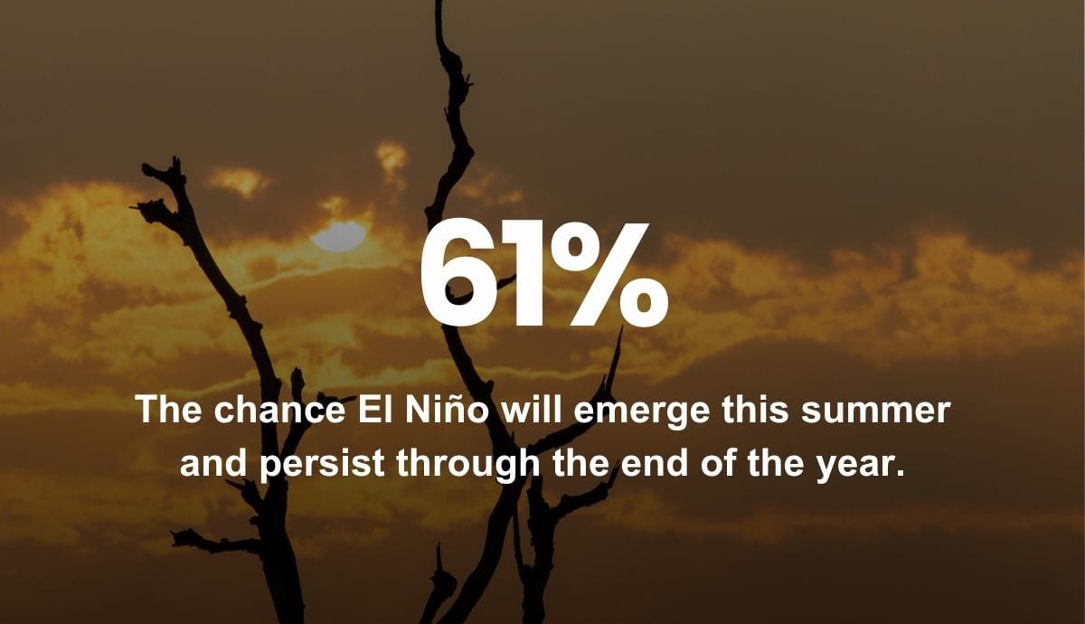
A new advisory from the National Oceanic and Atmospheric Administration predicts a 61% chance El Niño will emerge this summer and persist through at least the end of the year, impacting global weather patterns and pushing temperatures to record highs. NOAA also predicts a 1 in 4 chance of a “very strong” El Niño this year, aligning with forecasts from other weather agencies and research centers suggesting the world could see one of the strongest El Niños on record.
WHY IT MATTERS
El Niño happens when sea surface temperatures in the central Pacific Ocean are at least 0.5 degrees Celsius above normal, typically occurring every 2-7 years and persisting for anywhere from 9 months to more than a year. While there is no scientific definition of a “super El Niño,” the term is used whenever peak anomalies in sea surface temperatures reach at least 2 degrees Celsius above seasonal average. Forecasts suggest sea surface temperatures in the main El Niño region will exceed 2.5 degrees Celsius above average by October.
CONNECT THE DOTS
April 2025 to March 2026 was the hottest 12-month span ever recorded in the contiguous U.S. March 2026 was 9.4 degrees Fahrenheit above the monthly average, making it the hottest March on record and marking the first time any month’s average has exceeded 9 degrees Fahrenheit above baseline. Globally, experts believe it’s virtually certain 2026 will rank among the 10 warmest years on record, and will very likely place within the top 5.